Urban Environments
- Brownfield site: Derelict or underused industrial buildings and land that have potential for redevelopment.
- Counter-urbanization: A process involving the movement of population away from urban areas to a new town/estate/village.
- Re-urbanization: The development of activities to increase population densities within the existing built-up area of a city. This may include the redevelopment of vacant land and development of new business enterprises.
- Suburb: A residental area within or outside the boundaries of a city.
- Suburbanization: The outward growths of towns and cities to villages and rural areas. This may result from the out-migration of population from the inner urban areas to suburbs.
- Sustainable urban management strategy: An approach to urban management that seeks to maintain and improve the quality of life for current and future dwellers.
- Urbanization: The process by which an increasing percentage of a country's population come to live in towns and cities.
- Urban sprawl: Uncontrolled ans unplanned physical expansion of an urban area into countryside.
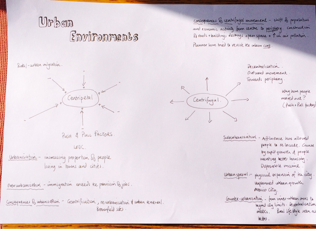
Centripetal movements
Push and Pull factors
- The process of urbanization
Push and Pull factors
- Rural push factors
- Urban pull factors
Centrifugal movements: The outward movement of a population from the centre of a city towards its edge or periphery resulting in an expansion of the city.
Consequences of centrifugal movement
- Suburbanization: An example of centrifugal movement started in about 1900's in Europe and in 1920's in USA. Nowadays, it is a worldwide phenomenon where increasing affluence has allowed urban residents to relocate caused by rapid growth of the urban population and a demand for better housing and more space.
- Urban sprawl: The physical expansion of the city area and is closely associated with suburbanization which is consequence of unplanned urban growth. Examples: Seoul, Mexico City and Riyadh. In 1970's Riyadh had population of 500 000 whereas in 2007 it reached population of almost 6 million which shows rapid urbanization.
- Counter-urbanization: The movement of people from inner urban areas to areas beyond the city limits. It is a process of population decentralization which follows on from suburbanization and its characteristic of wealthy cities in MEDC's. Counter-urbanization is response to the growth of the metropolitan area and population and the increasing stress of overcrowding, congestion, pollution, lack of community and declining services.
Consequences of centrifugal movement
- The construction of roads and buildings destroys open space and increases air pollution and at the same time, loss of population and economic activity is detrimental to the centre. Planners have focused on ways of receiving the urban core and restricting new construction in urban hinterlands (the zone surrounding a city).
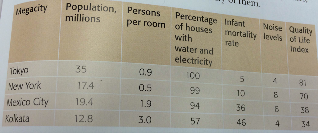
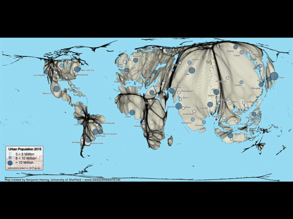
Megacities
Megacities are large metropolitan areas or urban agglomerations(area incorporating several large towns and cities such as New York) of 10 million inhabitants or more.
The megacity has been an important feature of urbanization processes which is initial stage and is followed by the expansion of the urban hierarchy(a national arrangement of urban areas for example from one large city to many small villages). They have a large number of specific problems and common characteristics which include high population concentration and density, uncontrolled spatial expansion, severe infrastructural deficits such as inadequate water supply and sewage and increased disparity between rich and poor.
The megacity has been an important feature of urbanization processes which is initial stage and is followed by the expansion of the urban hierarchy(a national arrangement of urban areas for example from one large city to many small villages). They have a large number of specific problems and common characteristics which include high population concentration and density, uncontrolled spatial expansion, severe infrastructural deficits such as inadequate water supply and sewage and increased disparity between rich and poor.
|
|
A millionaire city is a city with over a million inhabitants. They were generally found in MEDCs, such as London (7,753,600) and New York (8,363,710). However with the increase in globalisation they have spread in to LEDCs often at major trading ports, or areas that are becoming economic hubs – such as Mumbai (13,830,884) and Shanghai (13,831,900). 19% of the population live in millionare cities.
|
|
In 1920's London was the largest city in the world with its population growing rapidly and it was the first city that reached population of over 5 millions. In 1950's New York was the only urban area with a population of over 10 million. By 1985 there were only 9 megacities comparing to 19 in 2004. Megacities are defined as urban agglomerations instead of metropolitan areas. There were 25 megacities by 2010 such as Tokyo, Delhi, Shanghai, Mumbai, Mexico City, Beijing, Sao Paolo and New York. Tokyio is the largest metropolitan area while Shanghai is the largest city.
|
|
Case study: Shanghai
For 700 years Shanghai has been one of Asia's major ports until 1949 when China closed itself to trade with the west turning Shanghai from international centre of production to an introverted city. During 1970's China began opening its economy to the world and Shanghai was designated one of 14 open cities in which Economic zone was established in 1983 and in early 1990's an ambitious major programme of redevelopment was started. City was well placed to take advantage of the new opportunities offered by globalization. It became a major centre for export manufacturing based on automobiles, biotechnology, chemicals and steel and service industry sector helped to diversify its economy.
Between 1990 and 2000 Shanghai began to re-emerge as a world city. More than the world's top 500 transnational corporations and 57 of the largest industrial enterprises set up in Shanghai contributing to an annual regional growth rate of over 20% more than twice the national average. In 2009 it was ranked the 17th largest city in the world with a population of 15 million.
Today, Shanghai is a city-state within China. It is part of the Yangtze River Delta, the fastest growing urban area in the world containing 16 megacities including Shanghai. This region has 75 million people and earns 25% of China's GNP, 50% of its foreign direct investment. The city has been described as the largest construction site in the world: 4000 buildings with more than 24 storeys were under construction in 2010.
Managing Shanghai's rapid growth
Housing shortages and overcrowding problems are acute where almost half the population lives in less than 5% of the total land area and in central Shanghai population density reaches
40 000-160 000 people per km2. Population pressure is caused by in-migration,overcrowding, disparities in wealth and the social insecurities of Shanghai's poor population. Shanghais governmentbhas important policies to adress these problems:
Affluence and effluence
Water quality in Shanghai is a concern in which less than 60% of waste water and storm water and less than 40% of sewage flows are intercepted,treated and disposed of. Waste disposal is also a major problem. The construction industry generates 30 000 tonnes of building waste per day, and municipal landfill sites have almost reached capacity. Since the 1990's there have been marked improvements where municipal organic waste is now used as fertilizer in the surrounding rural areas.
Coastal flooding
Shanghai is under threat of coastal flooding, partly due to its low elevation at only 4 metres above sea level but also from monsoons and tropical cyclones. Future hazard events will be aggravated by climate change and the possibility of sea-level rise. The problem is compunded by subsidence, which has been caused by overabstraction of groundwater and the wight of high-rise buildings. Shanghai sank by 2.6 metres between 1921 and 1965 and in 2002 alone by 10.22 milimetres. The rapid development of Shanghai has presented the government and planners with some challenging problems, only some of which have been solved.
For 700 years Shanghai has been one of Asia's major ports until 1949 when China closed itself to trade with the west turning Shanghai from international centre of production to an introverted city. During 1970's China began opening its economy to the world and Shanghai was designated one of 14 open cities in which Economic zone was established in 1983 and in early 1990's an ambitious major programme of redevelopment was started. City was well placed to take advantage of the new opportunities offered by globalization. It became a major centre for export manufacturing based on automobiles, biotechnology, chemicals and steel and service industry sector helped to diversify its economy.
Between 1990 and 2000 Shanghai began to re-emerge as a world city. More than the world's top 500 transnational corporations and 57 of the largest industrial enterprises set up in Shanghai contributing to an annual regional growth rate of over 20% more than twice the national average. In 2009 it was ranked the 17th largest city in the world with a population of 15 million.
Today, Shanghai is a city-state within China. It is part of the Yangtze River Delta, the fastest growing urban area in the world containing 16 megacities including Shanghai. This region has 75 million people and earns 25% of China's GNP, 50% of its foreign direct investment. The city has been described as the largest construction site in the world: 4000 buildings with more than 24 storeys were under construction in 2010.
Managing Shanghai's rapid growth
Housing shortages and overcrowding problems are acute where almost half the population lives in less than 5% of the total land area and in central Shanghai population density reaches
40 000-160 000 people per km2. Population pressure is caused by in-migration,overcrowding, disparities in wealth and the social insecurities of Shanghai's poor population. Shanghais governmentbhas important policies to adress these problems:
- A combination of widespread family planning and medical care which has controlled fertility levels among the young immigrant population
- Compulsory work permits
- Educational initiatives to improve immigrant job opportunities
Affluence and effluence
Water quality in Shanghai is a concern in which less than 60% of waste water and storm water and less than 40% of sewage flows are intercepted,treated and disposed of. Waste disposal is also a major problem. The construction industry generates 30 000 tonnes of building waste per day, and municipal landfill sites have almost reached capacity. Since the 1990's there have been marked improvements where municipal organic waste is now used as fertilizer in the surrounding rural areas.
Coastal flooding
Shanghai is under threat of coastal flooding, partly due to its low elevation at only 4 metres above sea level but also from monsoons and tropical cyclones. Future hazard events will be aggravated by climate change and the possibility of sea-level rise. The problem is compunded by subsidence, which has been caused by overabstraction of groundwater and the wight of high-rise buildings. Shanghai sank by 2.6 metres between 1921 and 1965 and in 2002 alone by 10.22 milimetres. The rapid development of Shanghai has presented the government and planners with some challenging problems, only some of which have been solved.
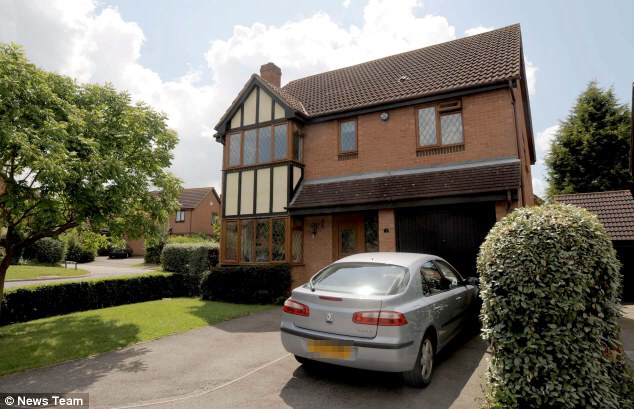
Residental patterns
Residental segregation: The physical separation of population by culture, income or other criteria.
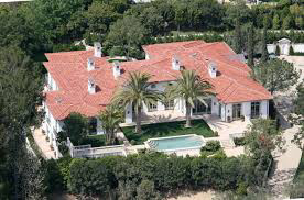
- Socio-economic status
Low Income Countries(Ghana)
- Lower class people's homes
- Middle class people's homes
- Upper class people's homes
High income countries(England)
- Lower class people's homes
- Middle class people's homes
- Upper class people's homes
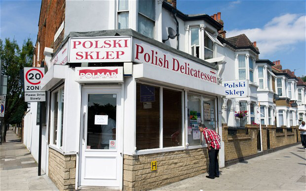
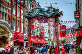
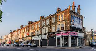
Ethnicity: The cultural differences between immigrants and exsisting residents often led to difficulties in communication, resulting in varying degrees of residential segregation. Over time many migrant groups have gradually been assimilated, while for others - in particular the more visible ethnic minorities - spatial segregation remains a fact of urban life.
- Polish area in London
- Chines area in London (China town)
- Balkan area in London
Examine the factors that determine the socio-economic characteristics and location of residential areas within cities.
In this essay I will examine the factors affecting the socio-economic characteristics and location of residential areas looking at historical concerns, physical concerns, transportation, location of industrial and commercial areas, wealth and ethnicity and the importance of urban processes including centripetal and centrifugal movements within cities.
Historical concern is very important socio-economic characteristic including residential tradition that have been in force centuries ago in certain city. Different class of people live in specific areas of the city. Wealthy people never want to live near middle class or lower class people which separated them to built houses in different areas. Place for wealthy people have been establish and settled and it is just recognized as a place of upper class. For example, wealthy people in London always choose the north side of the river Themes to live whereas poor people are on the southern side. In past people had separated in classes by river side which is still attractive fact in nowadays life having affect on people which side to choose for living. In my town, rich people live near the sea whereas middle class and poor class people live closer to city in buildings or houses. In previous centuries all rich families had houses near the sea so that historic tradition is still separating people in areas where they live.
Physical concern is the major factor for people to choose area where to live. In less hazardous areas, houses are often built by higher class whereas lower class live in slope and hilly areas. For example, in Rio De Janeiro this separation is clearly seen where we can see that poor people are living in narrow areas that might be washed away in time of huge run off which cause soil erosion washing away houses of those people. Their economical status is really bad that is linked with low income causing them to built less quality houses with inappropriate infrastructure non sustainable for disasters. This may differ from MEDC's to LEDC's. In Ghana, poor people live in shanty towns in polluted and less developed areas whereas location for rich people is in different part of the city where we can clearly see huge variations between poor and rich.
Transportation has its own characteristic creating picture of how lower, middle and upper class use different kind of transports in order to go in different parts of the city. For example, in MEDC's poor people often live in areas close to work and in city whereas rich and middle class people live in areas that are far away from crowd. Rich people use their own vehicles whilst middle class people use public transport. Poor people often walk to reach destinations where they need to go because their economical status do no allow them that kind of luxury. This is classified like that because rich people can afford their own transport, middle class people can afford using the public one but poor people can not afford because of low income which affect them to have different areas of living. Middle class lives near the public transport areas whereas rich people can afford to live in peaceful areas not having trouble to afford money for transport.
In city there are many rings separating different kind of areas. For example, in the center of the city there is commercial area where all businesses are established. It is very expensive area for living with high class stores and very luxury chains of different commercial centers. Industrial area is located far away from the center of the city occupying huge ring of industries where "blue collar" people work. Blue collar people are working class and they might live near their work place which is affecting their health in a bad way.
People in city are classified by their income. In nowadays society hierarchy contains wealth people on the top, middle class that separated in upper middle class and lower middle class and lower class. Upper middle class tend to live near rich people whereas lower middle class is often closer to the poor people whilst lower class contains poor people that are on the opposite edge comparing to wealth class people. This levels are created by their amount of income that they earn. Upper class live in luxury and peaceful areas far from overcrowded places whereas poor live in block buildings inside the city. Middle class people are on the way between wealthy and poor.
Ethnicity is defined as the cultural differences between immigrants and existing residents often led to difficulties in communication, resulting in varying degrees of residential segregation. Over time many migrant groups have gradually been assimilated, while for others - in particular the more visible ethnic minorities - spatial segregation remains a fact of urban life. Immigrants choose areas where people with the same nationality live. For example, Polish immigrants in London go in areas where are Polish because they have certain barriers and language problem which led them to feel more comfortable and teached and advised by people who have experienced the life in the city. This is how foreign people's neighborhoods begin to form within a city.
Urbanization, which is classified in the centripetal movements, is defined as an increase in the proportion of the population living in towns and cities within a country or region. Centripetal movements involve the migration of people into towns and cities. This process is really rapid in LEDC's where rural-urban migrants have a limited number of jobs available to them within a town or city. Wealthy people live in towns and cities with already established business having a middle class people working well payed jobs with a satisfactory income. Poor people are coming from rural areas into urban in order to find any kind of jobs because life is more safe, more healthy and has better life conditions which is pull factor for them. Push factors are factors pressuring people to leave area. Such as unemployment or poor life conditions and lack of food and water which make families unproductive to make families. In addition, the lack of jobs can be faced if a huge amount of people want to go in urban places where all the work places have been already in force which will make them unemployed and they are classified at the bottom of the hierarchy as the lower class people. Older people in cities may go in rural places to live because of crowd, traffic jams, crime, noise in order to have peace and not to be stressed. This process of movement of population away from inner urban areas to a new town or village with rural characteristics is called counter-urbanization. This is found in MEDC's.
Centrifugal movements is the outward movement of a population from the centre of a city towards its edge or periphery resulting in an expansion of the city.An example of centrifugal movement is suburbanization started in about 1900's in Europe and in 1920's in USA. Nowadays, it is a worldwide phenomenon where increasing affluence has allowed urban residents to relocate caused by rapid growth of the urban population and a demand for better housing and more space. The physical expansion of the city area and is closely associated with suburbanization which is consequence of unplanned urban growthis called urban sprawl. For example Seoul, Mexico City and Riyadh. In 1970's Riyadh had population of 500 000 whereas in 2007 it reached population of almost 6 million which shows rapid urbanization. However, people are still separated in different areas according to their income and class.
To conclude, I examined the factors that determine the socio-economic characteristics and location of residential areas within cities stating different variety of examples in real world. To sum up, income and class is really important factor that lead people to built houses in different areas.
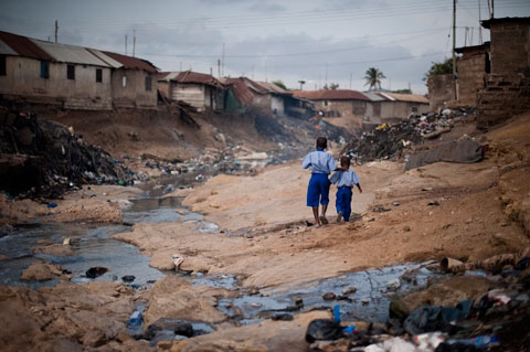
Urban poverty and deprivation
Within most cities there is variation in the quality of life. The areas labelled as poor are zones of deprivation, poverty, and exclusion. In MEDCs these are often inner-city areas or ghettos, whereas in LEDCs countries it is frequently shanty towns that exhibit the worst conditions. The factors associated with deprivation result in a cycle of urban deprivation and a poor quality of life.
Measuring deprivation
Deprivation is measured by number of indices such as:
1)physical indicators (quality of housing, levels of pollution)
2)social indicators (including crime and levels of health and access to health care, standards of education, proportion of lone-parent families)
3)economic indices (access to employment/unemployment and underemployment – levels of income)
4)political indices (opportunities to vote and to take part in community organization)
Slums and squatter settlements
The total number of slum dwellers in the world is around one billion in 2005 and it is estimated to reach 2 billion by 2030. This represent 32% of the world’s urban population but 78.2% of the urban population in LEDCs. Slums are typically located in areas that planners do not want – steep slopes, floodplains, edge of town locations or close to major industrial complexes.
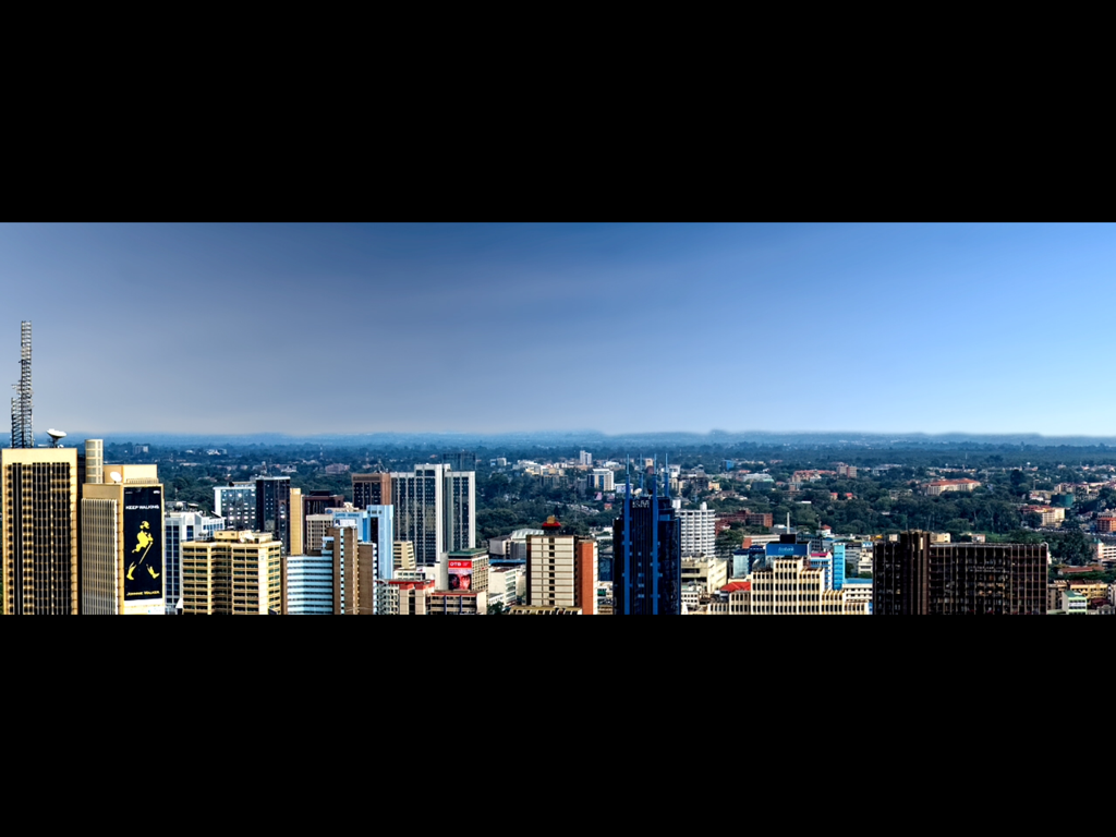
Nairobi, Kenya: functional zones
In Nairobi a railway was built in 1899 between Mombasa and Lake Victoria. The land that surrounded the river was swampy, malarial and uninhabited. A railway station was built despite these facts above. In less than a century later, the settlement at Nairobi had grown to over 1.5 million people. The present day functional zones are shown on a picture below.
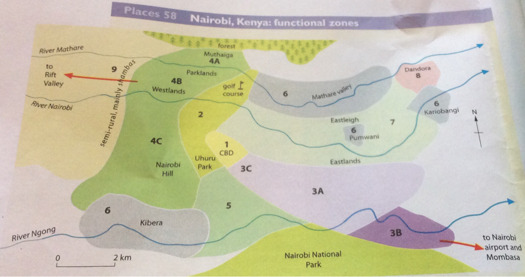
Zone 1 CBD
This is the centre for administration which includes the Parliament buildings, the prestigious Kenyatta, International Conference Centre, commerce and shopping and also large hotels and in the north the University and the National Theatre.
This is the centre for administration which includes the Parliament buildings, the prestigious Kenyatta, International Conference Centre, commerce and shopping and also large hotels and in the north the University and the National Theatre.
Zone 2 Open space
To the west and north of Nairobi's CBD there are several large areas of open space which include Uhuru Park and several other parks, sports grounds and a golf course. Other areas of open space lie outside the city boundary.
To the west and north of Nairobi's CBD there are several large areas of open space which include Uhuru Park and several other parks, sports grounds and a golf course. Other areas of open space lie outside the city boundary.
Zone 3 Industrial zone
Early industry grew up in a sector that borders the railway linking Nairobi with the port of Mombasa. The main industries include engineering, chemicals, clothing and food processing. A modern industrial area extends alongside the airport road and contains many well known transnational firms. This zone include Jua kali workshops.
Early industry grew up in a sector that borders the railway linking Nairobi with the port of Mombasa. The main industries include engineering, chemicals, clothing and food processing. A modern industrial area extends alongside the airport road and contains many well known transnational firms. This zone include Jua kali workshops.
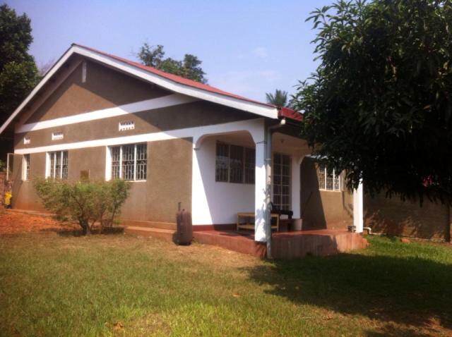
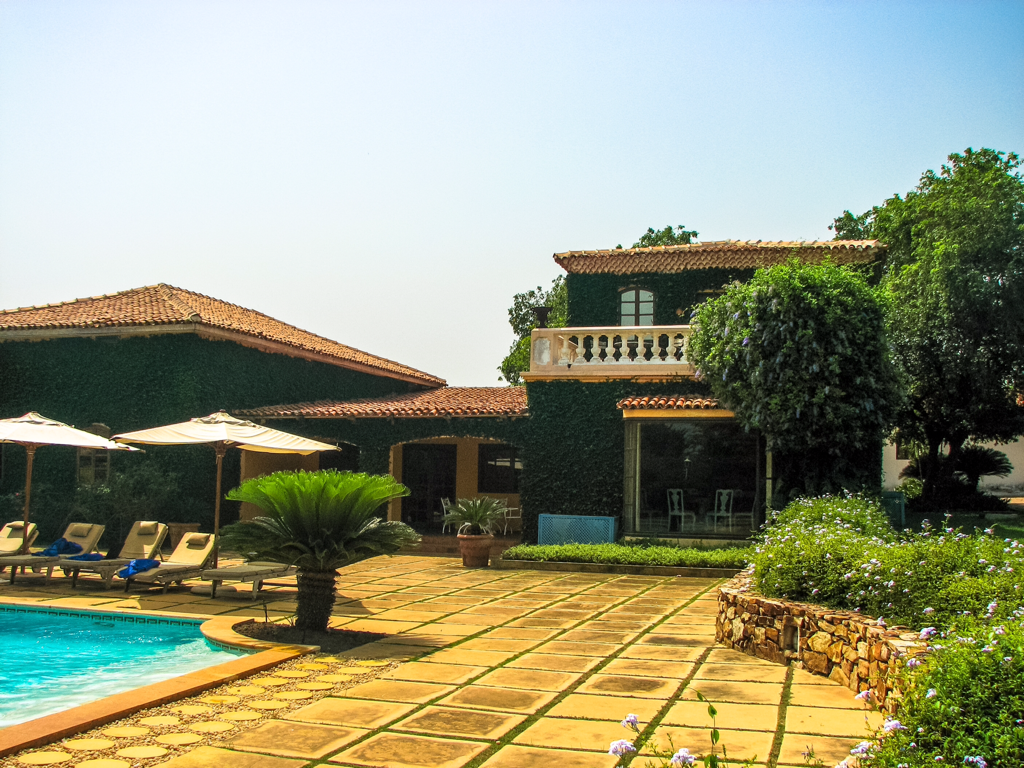
Zone 4 High-income residential
Wealthy European colonists and, later, immigrant Asians lived on ridges of highland to the north and west of the CBD where they built large houses above the malarial swamps. Today Europeans tend to concentrate in Muthaiga and the Asians and more wealthy Africans in Parklands and Westlands. Westlands forms a small secondary core while several large hotels are located on Nairobi Hill. Many of the largest private properties have their own security guards.
Wealthy European colonists and, later, immigrant Asians lived on ridges of highland to the north and west of the CBD where they built large houses above the malarial swamps. Today Europeans tend to concentrate in Muthaiga and the Asians and more wealthy Africans in Parklands and Westlands. Westlands forms a small secondary core while several large hotels are located on Nairobi Hill. Many of the largest private properties have their own security guards.
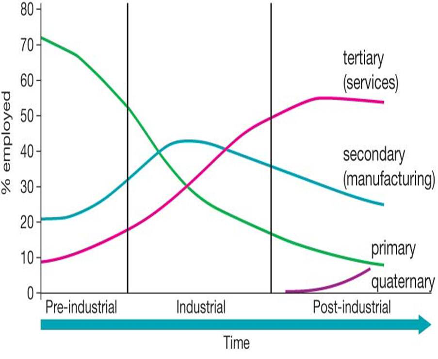
Economic Activities in Cities
Formal sector: Sector which encompasses all jobs with normal hours and regular wages and are recognized as income sources on which income taxes must be paid. It is composed of a group of people. The formal economy has an organized system of employment with clear written rules of recruitment, agreement and job responsibilities. The relationship between employer and the employee is maintained through a formal contract. The employee is expected to work for fixed hours and receives fixed salaries in addition to incentives. Besides, he is covered under social protection benefits such as life insurance, health insurance, pension, gratuity etc. People working in public sector units, government services, multinational/national/private companies, schools, collages, research institutes etc ... all belong to the formal sector.

|

|
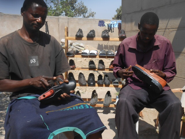
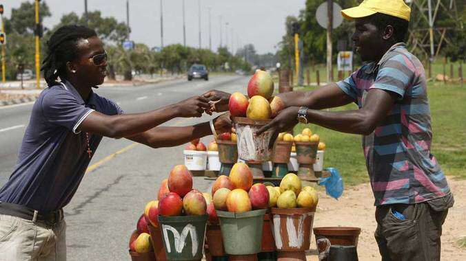
Informal sector: Sector which encompasses all jobs which are not recognized as normal income sources and on which taxes are not paid. Used to define illegal activity such as an individual who earns wages but does not claim them on his or her income taxes. However, the informal sector could also be interpreted to include legal activities, such as jobs that are performed in exchange for something other than money. The informal economy does not have any written rules or agreements and it exist merely on verbal understanding. It does not have fixed wages or fixed hours of work and mostly relies on daily earnings. In most cases the work atmosphere is congested and unhygienic. The workers in this type of sector usually fail to come together and address their problems through an association or a group. They have poor awareness levels. People working at small farmers, street vendors, hawkers, small trades, home-based workers, porters etc ... all belong to the informal sector.
|
|
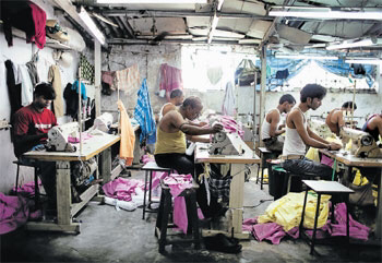
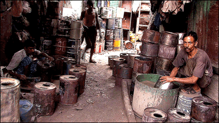
Case Study: Dharavi
Dharavi is located in the heart of Mumbai close to the fast developing commerical centre and to Mumbai's domestic and international airports. Dharavi is a unique, vibrant and thriving "cottage" industry complex which clasify it as the largest and oldest slum in Mumbai (the best known in India) with a population of more than 600 000 people living in 100 000 makeshift homes. Its population density is the highest in the world at over 100 000 people per square kilometre in an area barely half size of New York's City's Central Park. Although, the concentration of businesses could easily deter consumers, the large scale at which informality occurs yields an estimated $665 million in annual revenues. However, the economic success of Dharavi has a high cost in human welfare. The working environments and conditions are very poor, especially for the newly arrived casual worker. Environmental and health hazards are the realities that workers have to withstand to earn a living. Its population has achieved a unique informal "self-help" urban development over the years without any external aid. A study by the Centre for Environmental Planning & Technology indicates that Dharavi currently has close to 5,000 industrial units producing a wide range of goods including textiles, pottery, leather, plastics and poppadums. It also processes 80% of Mumbai's recyclable waste. Other residents are employed providing services such as transport for their own community or for Mumbaikers in general. Industrial activity takes place in nearly every home, with a workshop at street level and a living room above. Dharavi's informal economic activity is decentralized, home-based, low-tech and labour-intensive. It relies on close business networks within a stronlgy cohesive community. Enterpreneurs employing large number of cheap and flexible casual workers can compete in the national and international market, thereby indirectly contributing to the formal economy.
|
|
The Locations of Shanty Towns within Citie
- They are located on any available plot of land within or around a city
- The biggest concentration is found around the periphery (poor agricultural land and unproductive land-deserts and mountains)
- Shanty towns are strung out along lines of communication into the big cities-particularly the roads leading in from the poorer province from which the migrants have come.
- Within cities, different type of wasteland (along railway lines, close to factories, near warehouses and transport depots) provide locations ripe for shanty developments.
Dealing with Poor Residental Environments in LEDCs
- Shanty towns change through time and they generally undergo improvements in the quality of life.
- The achievemnt of these changes very much depends on the wealth of the country or city in question.
- Four theoretical stages of shanty town development can be recognised:
- The invasion stage (new arrival of migrants establishing shelters)
- The consolidation stage (occurs within 1-10 years of their establishment) although the actual building may still remain illegal, without basic amenities and in a very poor state, their are minor improvements in their inhabitants quality of life
- The upgrading stage (occurs between 10 and 20 years after their establishment) during this time self-help improvements and the laying on of basic amenities such as water and electricity greatly improve the quality of life of the inhabitants
- The assimilation stage (occurs after 20 years) when the shanty town fabric has been so improved that it becomes integrated as a normal and legal part of the city.
- The New Town approach which takes pressure off the city by building new housing areas at some distance from the city itself.
- The improvement of existing housing approach
- There are two main types of improvement approach:
- Upgrading (the role of the local authority is dominant)
- Site and Service (where the local govermnet lays on some amenities but encourages the slum dwellers to upgrade their buildings